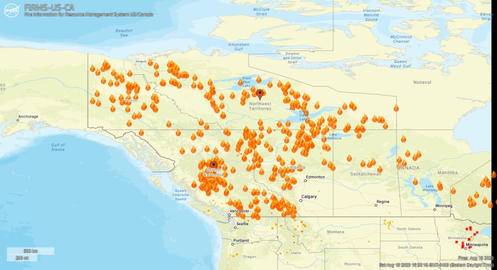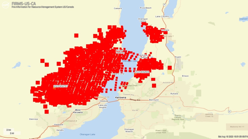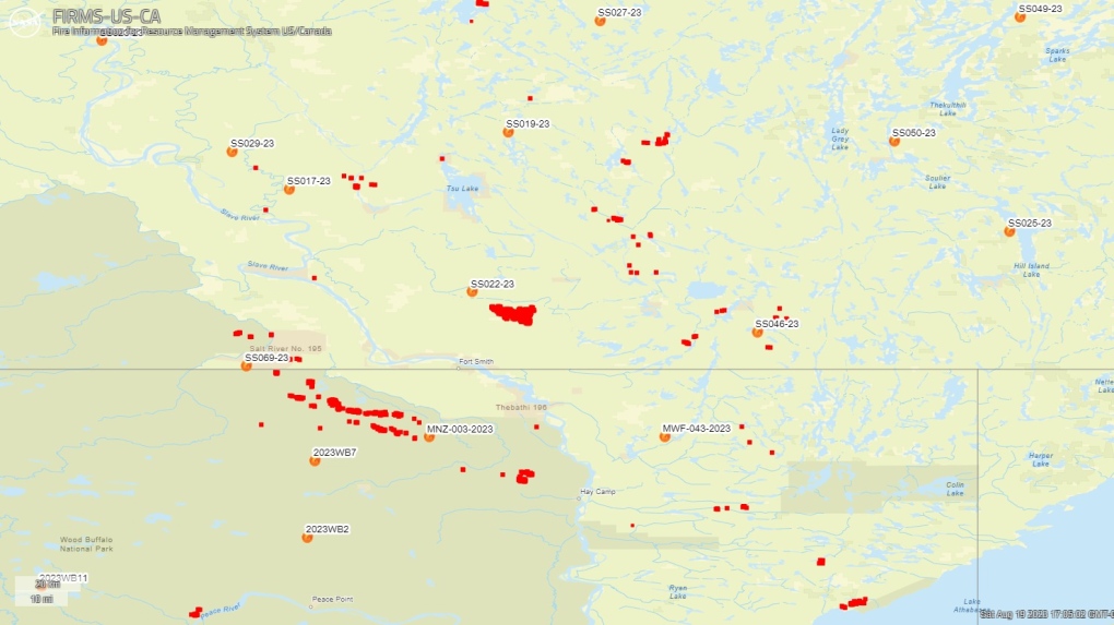
Utilizing data from NASA, a comprehensive visualization emerges, illustrating the widespread wildfires engulfing the Northwest Territories and British Columbia. These infernos have caused substantial harm to multiple towns, leading to the evacuation of numerous residents from their dwellings.
The collaborative effort of NASA and the USDA Forest Service has given rise to the Fire Information for Resource Management System U.S./Canada (FIRMS). This innovative system presents real-time updates pertaining to the locations of wildfires within Canada and the United States, along with their varying degrees of intensity.
Aerial observations captured by satellites unveil a striking panorama: vast sections of the western and northwest-central Canadian regions ablaze, depicted by a profusion of fiery orange icons. Notable among these fires are those situated beyond Yellowknife, N.W.T., and Okanagan, B.C., registering their active presence through this visual represent.
As of Saturday afternoon, the tally reveals a total of 236 live fires in the Northwest Territories, while British Columbia contends with 380 active blazes.
The map highlights the ongoing struggle on both shores of Okanagan Lake, where crimson-hued icons denote “thermal anomalies” associated with the fires in the vicinity. Furthermore, the dataset provides insights into the duration of hotspot activity. According to the map legend, icons shaded in shades ranging from orange to light yellow indicate that a substantial portion of the fires in that particular area have persisted for a duration exceeding 6 to 24 hours since their initial detection.

The majority of the wildfires in northern Canada are concentrated in the expanse between Fort Smith and Hay River, N.W.T., extending into northern Alberta. The Alberta Wildfire status dashboard reports the presence of three uncontained fires within this region.
An unparalleled wildfire season has swept across Canada, resulting in the scorching of thousands of kilometers of land. This catastrophic event has compelled countless residents to evacuate their homes, seeking refuge in neighboring towns, provinces, and territories.


